Deep-Learning satellite multi-view stereo survey
深度学习方法下卫星图像 MVS 综述
1.常用数据集
| 预览 | 名称 | 相关链接 |
|---|---|---|
 |
WHU-TLC | WHU-TLC dataset |
 |
US3D | Urban Semantic 3D Dataset |
 |
Public Geospatial Datasets | datasets |
2.部分文献代码
3.相关文献列表
3.1 基于 RPC 模型的遥感图像 MVS 方法
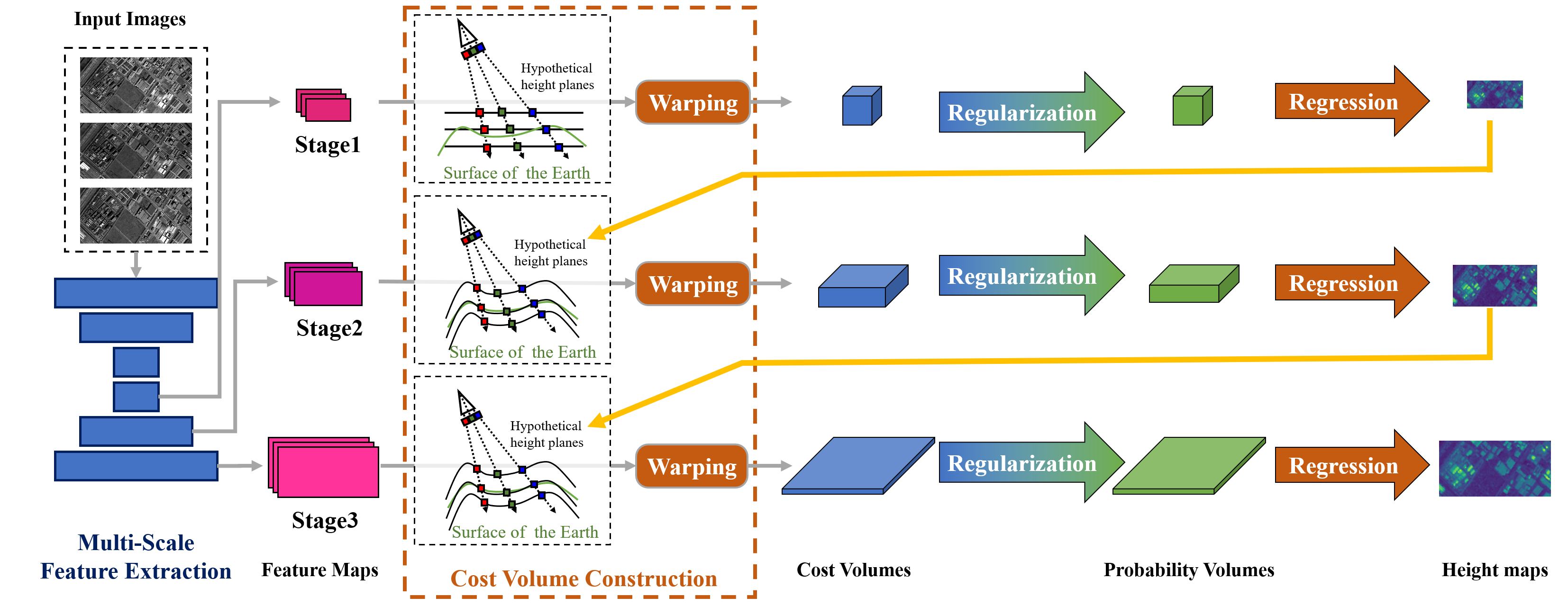
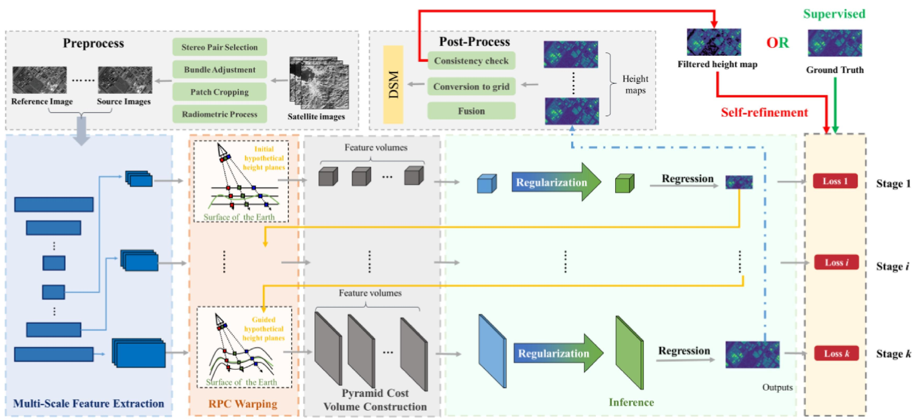
- Rational Polynomial Camera Model Warping for Deep Learning Based Satellite Multi-View Stereo Matching
- A general deep learning based framework for 3D reconstruction from multi-view stereo satellite images
3.2 基于 Cost-Volume 增强的方法
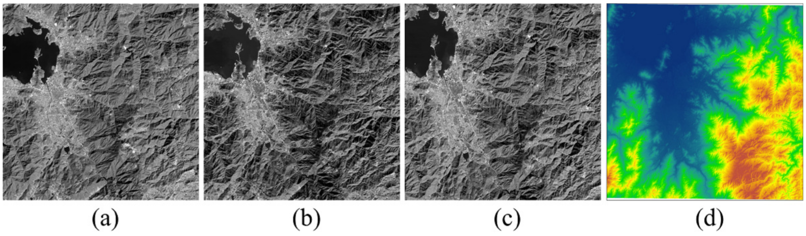
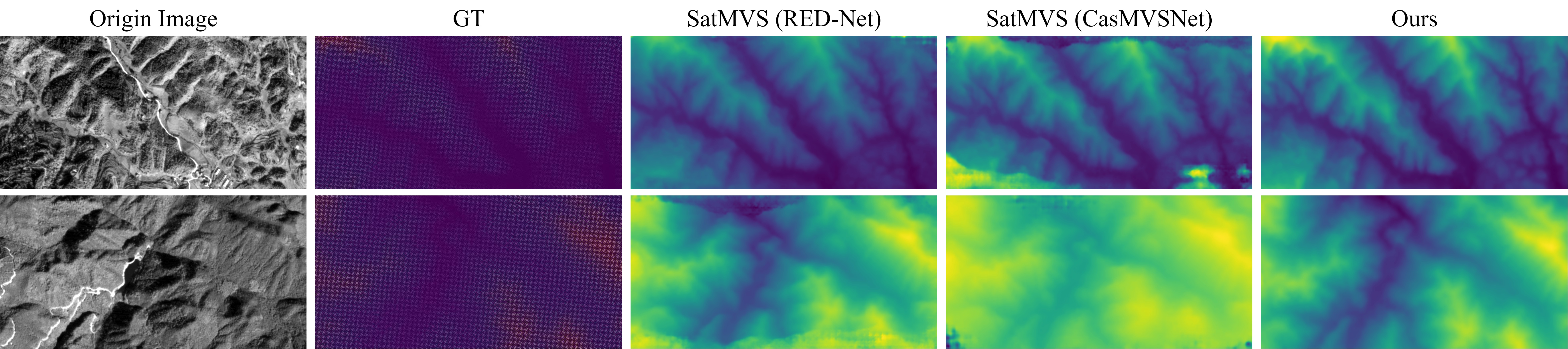
- RS-MVSNet: Inferring the Earth’s Digital Surface Model from Multi-View Optical Remote Sensing Images
- Deep Learning-Based Digital Surface Model Reconstruction of ZY-3 Satellite Imagery
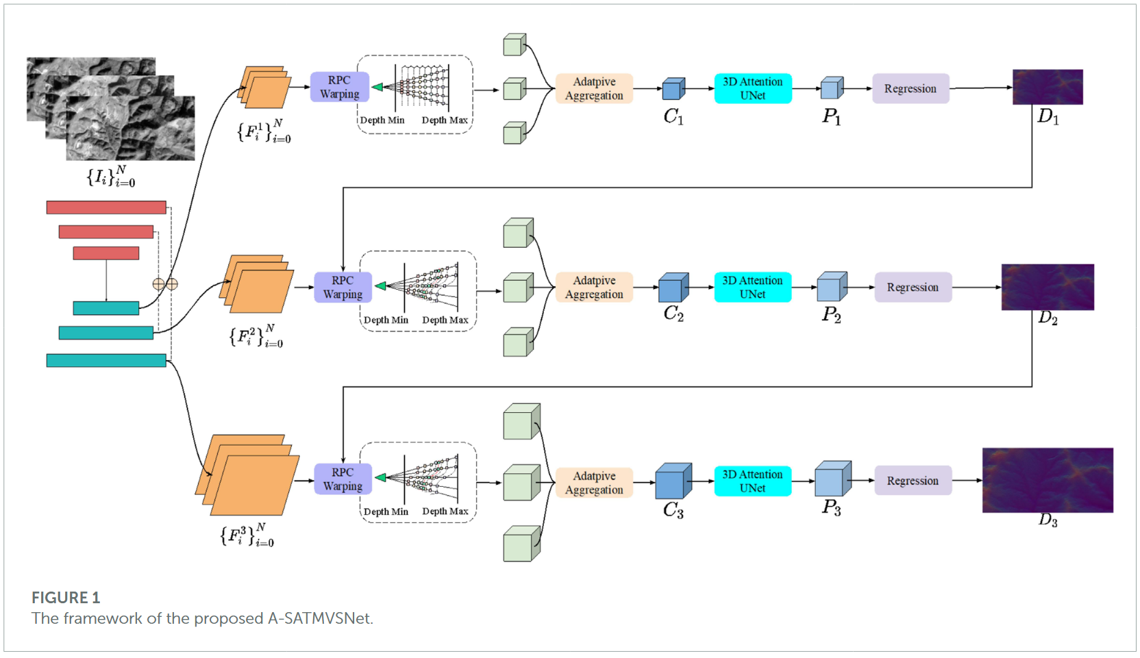
- A-SATMVSNet: An attention-aware multi-view stereo matching network based on satellite imagery
3.3 基于特征提取增强的方法
- Surface Depth Estimation from Multi-view Stereo Satellite Images with Distribution Contrast Network
- Highly Applicable Iterative Network for 3-D Reconstruction Based on Multiview Satellite Images
- SDL-MVS: View Space and Depth Deformable Learning Paradigm for Multi-View Stereo Reconstruction in Remote Sensing
- Surface Depth Estimation from Remote Sensing Images Based on Cross-Level Feature Representation
3.4 基于 foundation model 融合的方法
3.5 基于几何约束引导的方法
- SA-SatMVS: Slope Feature-Aware and Across-Scale Information Integration for Large-Scale Earth Terrain Multi-View Stereo
- TS-SatMVSNet: Slope Aware Height Estimation for Large-Scale Earth Terrain Multi-view Stereo
- A Structure-Preserving Multiview Stereo Network for Edge-Aware Height Estimation From Satellite Images
- Remote sensing multi-view stereo using ConvLSTM guided iterative depth refinement